You can definitely cross the 40th st bridge. They completed the new pedestrian path that leads from the millvale riverfront park on to the sidewalk on the 40th st bridge, which is a good way to cross.
2012-08-17 12:43:11
So I sent stu a pm a while back but it seems the website isn't working really well. So I will open it up to the public.
I am looking for the most practical route to get from the city to the north hills. I'm specifically looking to get to the neighborhood near Babcock and McKnight. If anyone is familiar, there's a hill near the doggy day care (formerly USA baby way back in the day). There is also a "secret enterance" to this neighborhood if you are driving from 279 onto McKnight. There's a sort of hidden turn off down the hill a little bit from the Rogers driving school. I would love to enter this way but that would mean biking the shoulder of McKnight for a little bit. There's plenty of shoulder but I'm not sure anyone here would recommend that still.
But anyway, what route would you suggest from the city to here? I am thinking 16th street bridge to east street, or perhaps through Millville if the 40th street bridge is available for bikers. Not sure about that because I think it spits you out near 28 and that looks a little dangerous to me. But I haven't been there in a while.
Any suggestions would be appreciated. I've always wanted to try this. Thanks.
You can definitely cross the 40th st bridge. They completed the new pedestrian path that leads from the millvale riverfront park on to the sidewalk on the 40th st bridge, which is a good way to cross.
+1 on the 40SB
If possible use the upstream/east walkway, which flows seamlessly into the trail connector. Also the west side has been caked with broken glass for the past month or so. I put in a 311 to have it swept but as of yesterday it's still a flat waiting to happen.
I ride along Babcock a good bit for exercise rides and wouldn't hesitate about it. From the city I will get to River Ave via the trail and ride the road to Riverfront park and then take the main road in Millvale to Babcock and that would take me to Camp Bow Wow and the hill you speak of. The rest I do not know.
I am with Orion on this one.
North Shore Trail to Millvale.
Any of the commercial streets in Millvale to where they T. Right on North Avenue. Stay on North Avenue until it merges with Evergreen near Hardees/Ritas.
Continue to follow Evergreen. Somewhere near Rita's it becomes Babcock.
At the big busy T (stoplight, laundromat, former Evergreen Hotel) a left will put you on Peoples Road. From here you can take a right on the next fairly big intersection, and this will put you on Nelson Run, which I think is the weird little street off of McKnight that you reference in your original post. I've driven this road, but never cycled it. You might want to preview the entire length of it, or plan to do the ride during low trafic hours. My recollection is that it is narrow and windy, with some interesting changes in elevation.
Alternately, if you coming from town, you could take East Street (yucky, but doable) to where it turns into Evergreen. Stay on Evergreen. At Ivory Avenue, you can turn right, and access the back end of Nelson Run, as above, or turn left. Depending on where you want to go in that little cul de sac area, you can turn right on Cherryland, left on Brethauer to Nelson Run, or continue on Ivory across McKnight to a right directly onto a lowered Nelson Run that passed under McKnight.
Weird location to get to, but not terrible, in my estimation.
> Also the west side has been caked with broken glass for the past month or so. I put in a 311 to have it swept but as of yesterday it's still a flat waiting to happen.
40SB may be a state responsibility. Try calling 1-800-FIX-ROAD, PennDot's pothole-and-road-hazards report line.
I never got the PM, sorry.
Suggestions so far are right on the money.
Nelson Run gets a car every 5 minutes. Low traffic speed. Easy climb. Rotten pavement.
Also note there are two, may as well say three, intersections of Babcock and McKnight. The one in question is the southernmost, near the U-Haul and Red Lobster on McKnight. Babcock meets McKnight, and is actually part of McKnight, at the Ross/McCandless border, near McIntyre Square.
I don't like the East to Evergreen method. High traffic speed, high traffic volume, and a huge curb all the way up.
I know, I contacted the site maker and he said the site was having problems with messages and they are going to make a new site soon.
Is the north shore trail the one at the casino? I Thought that went up to 65 near bellvue. Not too familiar with it though.
Sorry, was using my shorthand in the directions. North Shore Trail (to me) means the trail that I access on the north side of the Allegheny River, near PNC Park.
From there, the trail heads towards Chateau (westbound) or Millvale (eastbound).
For these purposes, I should have called it the Millvale Trail.
The 16th and 40th Street bridges will also get you to this trail, then head AWAY from downtown to the Millvale Riverfront Park.
Follow the park road to a left turn under the underpass. Cross the ramps to Route 28 (there's a new pedestrian signal call button that makes crossing to the commercial district in Millvale easier than it used to be.)
Follow the street past the family dollar store, etc. a few blocks (4 maybe) to where it Ts. You'll be in the heart of the Millvale Business District.
Turn Right on North Avenue, then stay straight on Evergreen/Babcock to really really big T, with stop light, etc. Most traffic will going right to stay on Babcock. You will want to go left, as noted above, then right onto Nelson Run. If I recall correctly, this is not a complete four way intersection, or if it is, the street you want goes off on a slight angle. I may be wrong on that, but that's my memory.
Im not sure exactly where you are trying
to get. Do you have an address?
You can go
16th st
Spring garden or troy hill to Mt Troy.
Right on Mt Troy Ext
You can turn right and go down Peoples TWP
Road, which puts you down to a busy 4 lane.
You can go straight across that onto
nelson run, which is a cool road that does
not really go anywhere, but takes you up
to the PR0n store on Mcknight.
All of those roads are pretty quiet. I ride
a lot of them for fun to avoid traffic.
I thought of Spring Hill to Mt. Troy, but that requires a lot more climbing that going through Millvale.
Although I love the cemetery at on Mt. Troy Road.
The left from Babcock onto that 4-lane road isn't difficult, and you're only on it a couple hundred yards. Decent shoulder, not too horrible. Then the right onto the little moonscape that takes you up to the, um, novelties place.
@ Steevo - I believe he is talking about Donmor Dr area. I was going to use Brookview Lane but there are two in that area. Brookview Lane runs between McKnight and Babcock near the junction of McKnight and Babcock (the one closer to 279...that road is so screwed up).
Babcock's tendency to cross the same road multiple times illustrates the fact that I'm a townie, not a suburbanite at heart.
I was on it once, on an overcast day (couldn't tell sun's direction), and thought I turned east from McNightmare road onto Babcock, towards rt 8. Ended up over in Sewickley after somehow turning around on myself but not noticing (and I didn't think I crossed McNightmare again, but who knows). Didn't know what happened until I hit the river and figured out it was the wrong frigging river.
I've eschewed Babcock ever since.
Good luck!
Try giving directions to follow it...go to the light and make a right which is still babcock...3 more lights and make a left onto babcock...then take the exit right onto babcock...WTF!!!
I used to live near there (still pretty close). Crazy.
+1 for Rita's on the way home.
That's driving it. Biking it, there are SIX places where you have to get left of a right-lane peel-off if you want to go straight. This is a bit tricky, probably scary as hell for curb-huggers.
But having said that, I will still pick Babcock over Perry or McKnight if all you want to do is get north. Low traffic speed, low traffic volume, and steady, Granny-capable 80-foot-per-mile climb.
The six peels are:
1) Near Rita's.
2) Thompson Run Rd
3) Peel for northbound McKnight
4) Peel for southbound McKnight
5) Siebert Rd
6) Corner with Three Degree (because I'm usually headed straight into behind the car wash)
To get to Nelson Run, you'd have to deal with the first of those. They're not that difficult, but a heads-up is in order.
Ahh, so the trail does go into Millvale - I didn't know that. I took the trail once, and I ended up on that little island (going up a ramp and then into the residential section of the Island). This was about a month ago, and I wasn't allowed to cross back over the 40th due to some constuction. Edit - that might've been the 31st now that I see the map. So, I stay on the shore, and not go up the walking ramp?
So if I just stay on that trail, I'll make it to Millvale? That's great, I can navigate myself from the Hardees as long as I can get there. Thanks!
Yep. Where the River Road ramp heads up to what used to be the 31st Street bridge, stay on the trail. Don't cross over the bridge to the Island. After a short distance you'll come to the new "bridge structure" (you'll know it when you see it, or when you hear it. Your bike will go "thump, thump, thump at each of the pavement joints on the structure, and there are a ton of them.)
When you enter the park, stay on the trail past the big picnic shelter. It will then cross you over the park access road to the far side of the road. When the overpass opens to your left, take that. Be careful crossing the RR tracks -- they are in use.
You can see the edge of the red Family Dollar sign from the intersection of the Park acces road and Route 28. Just head for that, and then head past it.
Just FYI, Millvale is full of interesting stuff, including a Pamela's related diner, an old fashioned hobby store, a great used records store, a really special french bakery, a home made candy store, and much more. Keep your eyes open as you ride through. It's a fun place.
If you miss the overpass, you'll no longer be beside a road. If you keep going, you'll get to sharpsburg. It's super easy and straightforward...
Oh, earlier, when you get to a wide gravel stretch, keep right near the river and up a super short steep little hill. Going left will put you on the other side of the boat house. You won't get lost, but cars park and pedestrians carry boats and other strange things happen over there. Staying on the trail is easy.
Thanks, I remember that french bakery when I was growing up. I think it flooded and the guy still re-opened.
Just found the bakery, their web site is advertising cute little red-white-blue macarons for summer. And I'll be right there Saturday morning to go running...mmm...
yup, Millvale now wins. You can't argue with Macarons. They're the real secret behind the Tour.
french bakeries are cool and all, but call me when there's a legit boulangerie.
+1 Millvale. Pamela's Pancakes, the french bakery, good trailhead. They keep the trail restrooms locked though.
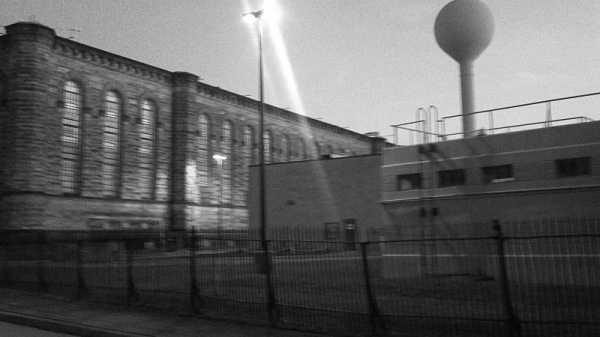
The naming of the trails is an ongoing amusement to me. I would like to submit for your consideration that the trail from the stadia past the casino to the state correctional facility (Western Pen, not to be confused with the hospital Western Penn) should be called the Bastille Trail (since we already have a Jail Trail)

bastille valley heritage trail?
It's tough to argue with a guy who actually knows the Latin plural of "stadium."
I've always wanted to have a Bastille Day ride. I even own a 2' x 3' Frenchy flag.
btw, there's a french bakery in lawrenceville, too, so you don't even have to cross the river to get your macarons...
(unless you're on the south side/shore/hill/place, in which case... sorry?)
@edmonds59 - that's brilliant. July 14, Bastille Day Ride. I've got it on my calendar. V.
Ok, it's a deal. I've always kind of wanted to storm the Carnegie's $125/plate Bastille Day celebration. I don't see how they can't see the irony of that. 