BIKEPGH MESSAGE BOARD ARCHIVE

« Back to Archive
42

New Bike Lanes on Wilkins

Just heard from the City's traffic engineer today that the company started striping. I have not seen them yet so I have not idea what they look like.


Note: The City designed these lanes not BikePGH. We hope they're great, but we did not get to vet the design.


scott
2010-11-10 05:05:24

where on wilkins? i didn't see anything between beechwood & negley - not that i'd expect them there.


fwiw, i'd settle for a sign somewhere on the downhill between shady & murray that says "passing a bicycle here proves you're a moron, so cyclists are permitted to shoot you in the head to test for brain function as you go past". not sure what the graphic for that looks like though.


salty
2010-11-10 06:14:01

Between dallas and beechwood, probably. That is a school zone with lots of speeding so it seems like a prime target for passive calming efforts instead of active enforcement.


But for bikes it's superfluous. Please tell me they aren't painting a door zone bike lane on the downhill side. This is on my daily commute, and I'm going to be so disappointed if this is effed up.


lyle
2010-11-10 12:13:25

We requested sharrows on the downhill side, bike lane on the up, but we were never provided with the designs.


scott
2010-11-10 12:57:03

The Pop City blurb here says: Some of the improvements being made today include the completion of the Fourth Avenue lane connecting South Braddock to the CMU campus via Squirrel Hill, a new lane going up Dallas Avenue through Wilkins Avenue and then through Shady Avenue, and a new sharrow on Hamilton Avenue in East Liberty." It cites Bike Pgh as a source.


Any idea what this "Fourth Avenue lane" is? I can't figure out where this is supposed to be.


chinston
2010-11-10 15:20:59

Forbes Avenue -- bad speech recognition software in the Pop City reporter-bot.


lyle
2010-11-10 15:53:20

Ah. That makes more sense!


chinston
2010-11-10 15:54:45

@lyle But for bikes it's superfluous.


+1


Fine as it was.


On the other hand, if they extended this lane up shady to Forbes? Having a route *to* something like the Forbes business district would be an acoomplishment and the Wilkins lane would be part of that.


mick
2010-11-10 16:10:16

They put a DZBL downhill :(


I should have stopped to take pictures, sorry. I'll try to get some within the next day or two.


@Mick, shady to forbes is not my favorite way to get to the forbes business district for a couple of reasons. I prefer wilkins to murray. However, there are lots of good secondary routes involving Northumberland, or Aylesboro, and Deniston or Murray. Wilkins to Beechwood to Aylesboro to Deniston and then to Forbes is a real nice low-traffic route that is even suitable for (well-trained) kids.


(what I really want on Wilkins is grinding down the washboard eastbound at Dallas. That's a hazard -- it makes braking and turning dangerous at ordinary bicycling speeds.)


lyle
2010-11-10 16:45:17

+1 to the poor road condition on Wilkins at Dallas, lost a chain there once.


namtrahselrahc
2010-11-10 17:33:03

please call or email 311 when you see poor road conditions.


erok
2010-11-10 18:33:32

Haha. I mean, point taken, but, I wouldn't know how to prioritize. I'd just be the crazy guy who left the four-hour message on the 311 line.


lyle
2010-11-10 18:36:06

call early, call often


erok
2010-11-10 18:45:19

Just send a message through the 311 form online.


rsprake
2010-11-10 18:47:09

just rode these tonite. they're obviously not done, and i think there are supposed to be sharrows after beechwood as well.


I felt pretty good in them. i was fairly displeased with the placement of the Liberty Ave downhill bike lanes, but these don't feel bad. there are a few spots where i would definitely call this a door zone bike lane, but for the most part, i feel it's far enough away from the doorzone where even right of middle is out of the dz. There also weren't very many cars parked here, and it's all residential except for wheel deliver.


do i feel the lanes could move over more? yes.


i really like what they did around the intersections with the dotted lines, especially the long intersection at Barnsdale.


the surface does suck. it was repaved not that long ago, but i bet they didn't remove the old tracks before putting the pavement on.


erok
2010-11-10 23:42:48

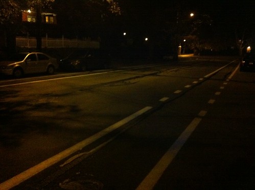
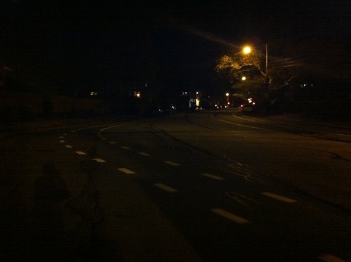
Took a couple photos tonight. The new paint is from Beechwood to S. Dallas.


Here the lane swings wide around the curve.


New Wilkins Ave bike lane


An example of how the intersections are treated.


New Wilkins Ave bike lane


A better solution would have been to follow Bike PGH's advice and do sharrows downhill and a buffered lane uphill.


rsprake
2010-11-11 03:04:50

Might have to take a long detour on the way home tonight to see this.


ieverhart
2010-11-11 03:53:35

It would be so great to have the parking outside the bike lane. After seeing the Streetfilms stuff...


edmonds59
2010-11-11 11:37:59

You don't ride that block of Wilkins very often, do you?


lyle
2010-11-11 12:27:03

No, I was talking rsprake's photos of Beechwood. Wilkins not so much.


edmonds59
2010-11-11 12:49:53

I went to elementary school at Linden there, and I walked to school from ages 7-10 from Ridgeville (near Northumberland), literally three blocks away. I walked by myself. I was supposed to walk all the way up to the intersection at Beechwood, then cross and go in the front door. Right. I usually waited until I didn't see any cars (especially my mother's car) and sprint as fast as my mini little legs could carry me all the way across the 8 lanes wide road. But even then it was sometimes too scary or there was an Adult With More Sense who saw me eyeballing it and yelled at me and saved my life (see previous thread requesting admonitions against Stupid Shit).


Why, oh why, why why why why do they not simply get rid of the road that isn't needed? Why was it paved in the first place, because the school groundskeeper didn't want to mow it? Give it to the school. Give it to the neighbors. Give it to a farmer to herd migratory buffalo on. It's a total waste of pavement and maintenance money.


ejwme
2010-11-11 13:47:50

I always thought Wilkins was wide, curved and graded the way it is because it used to have a street car line on it? From 5th all the way to Dallas it has easy curves and smooth grades. So they put that extra width in to accommodate the trolley and cars when they had the opportunity. But perhaps not..I've never checked.


I took a little detour on my way to work this morning, down Beacon to Beechwood and jogged over to Dallas and then up to Wilkins. There wasn't any lane marked on Dallas as the Pop City blurb @chinston linked for us above said there might be--and I found myself wondering how they'd mark that stretch which is fairly narrow. Maybe sharrows?

Hard to fit a full lane on each side.


Lyle is right, putting lanes on Wilkins in that particular block is pretty much superfluous for bikes as the road was already plenty wide. The block between Beechwood and Shady would have been a better candidate but again it's much narrower and therefore harder to do. Meanwhile, it just looked like paint to me. So I assume they'll be fading by spring.


jeffinpgh
2010-11-11 14:58:57

rsprake A better solution would have been to follow Bike PGH's advice and do sharrows downhill and a buffered lane uphill.


+1.


mick
2010-11-11 15:02:05

i don't think it's necessarily superfluous. adding lines to demarcate where cars are supposed to be helps make sure they stay there, predictably. i rode this route pretty much everyday for 10 years and cars would sometimes take that curve wider than necessary because they weren't slowing down. wide = fast.


erok
2010-11-11 15:13:20

@erok, that's a good point (although I still often see cars using the bike lane as a travel lane on East Liberty Blvd). Wide does often equal fast. Perhaps this will slow some folks down. I still wonder how they'll mark Dallas, which could use some slowing down of traffic.


jeffinpgh
2010-11-11 15:38:57

it's supposed to be a combo of lanes/sharrows and should be marked from beechwood to hamilton


erok
2010-11-11 15:41:59

Do you mean Wilkins to Hamilton? The City Paper mentioned Forbes..


Well they mentioned Fourth actually--but since Fourth Ave. is only downtown we can assume they meant Forbes.


jeffinpgh
2010-11-11 16:05:50

Forbes is a different set. I assume they are planning to connect the Forbes through Frick Park bike lanes with sharrows through SQ hill and connect to Wightman.


rsprake
2010-11-11 16:19:42

I realized Forbes is a different set. But I was referring to this from the City Paper (as linked above)

"Some of the improvements being made today include the completion of the [...]a new lane going up Dallas Avenue through Wilkins Avenue and then through Shady Avenue, and a new sharrow on Hamilton Avenue in East Liberty. The new lanes and sharrows will be painted with specialized thermoplastic, a material which can last up to seven years."


a) didn't see anything on Dallas but assume from the context it was starting at Forbes (Fourth int he article). Perhaps I shouldn't.

b) Lane did not extend to Shady, just Beechwood

c) Thermoplastic? Seven years? What did it look like to you? As I said above, looked like plain paint.


{edit} maybe I should remember not to get news from the City Paper.


[2nd edit] I suddenly realized Erok probably did mean Beechwood to Hamilton--right where the Bike Lanes on Beechwood intersect with Dallas and then Dallas crosses Forbes immediately after that...


jeffinpgh
2010-11-11 16:49:04

Was it just lines? Could be they will put the bike symbols in using thermoplastic, and use plain paint for the lines?


dwillen
2010-11-11 16:56:53

that's right dwillen. that seems to be the plan for now. paint for the lines, thermo for the markings, especially the sharrows. since it's different equipment, it will be done on different days.


please don't take the pop city article as knowing what it's talking about. it is not "fourth ave"


the two bike lane parts on forbes in squirrel hill should be connected. there is also potential on sharrows thru uptown on forbes, as a solution until a better facilities can be engineered


erok
2010-11-11 17:11:05

as a solution until a better facilities can be engineered


@erok, speaking of that are you guys involved in the talks about But Rapid Transit on Forbes/Fifth? Seems like an opportunity if they are going to be changing traffic patterns there.


jeffinpgh
2010-11-11 17:16:05

@jeffinpgh, yes we are involved in those discussions around BRT.


scott
2010-11-11 19:23:42

@Scott. Great! Thanks.


jeffinpgh
2010-11-11 19:26:05

I just looked at the archive of historic Pittsburgh maps, and it doesn't show streetcar lines in either the 1925 edition or the 1939 edition, the two most likely times to find them if they were to be there.


I would be interested to see a detailed map of Pittsburgh streetcar routes, if anyone knows of one that already exists...


ieverhart
2010-11-13 00:24:34

hm... well, i have a paper map dated 1872 that shows wilkins ending at shady. clicking around the pitt maps archive, that looks to be the case until at least 1898 - on that map, it continues to Denniston (labeled as Linden) with an (unbuilt? dashed-line section) to Beechwood. In 1904, it looks the same except renamed to Wilkins and the section in question (Beechwood to Dallas) is now present as a dashed line.


In 1910 & 1911 it looks like the Beechwood to Dallas section is completed, but the one between Denniston and Beechwood is still not. Hard to tell if that's still the case in 1923 due to the plate boundaries.


Nothing terribly helpful about trains or streetcars... there doesn't seem to be too much on the net about it :(


salty
2010-11-13 04:43:42

Wikipedia lists the old streetcar routes, and links to this 1915 street guide.


That says Wilkins is served by the 76 and 79 streetcar routes. Here are their descriptions:


76 HAMILTON AVENUE.

Every 10 minutes. R. T., 47 minutes.

From Fifth and Market, along Fifth to Hamilton, to Brushton, to Tioga, to Wilkinsburg.

Last Car leaves Fifth and Market at 12:26. Night

cars, use Route 77.


79 FORBES SHADY AND PENN, going out Fifth.

Every 15 minutes. R. T., 32 minutes.

From Fifth and Penn, along Fifth to Sixth, to Forbes, to Shady, to Penn, to Fifth.

Last Car leaves Fifth and Market at 12:15.


So it looks like there were no streetcars on Wilkins in 1915.


The 1915 street guide is full of interesting material, by the way.


steven
2010-11-13 15:04:21

@ Steven -


Oh. My. Goodness. That is a wonderful find. Goodbye, productivity, while I digest that.


ieverhart
2010-11-13 19:41:26

We've come a long way since the city was spelled Ptitssburgh (bottom of page 3).


Good luck in giving someone directions to Ormsby, Minersville or Shalerville. Nunnery Hill isn't well known, but gets a mention periodically.


stuinmccandless
2010-11-13 20:12:05

Every 10 minutes! Cripes. Those were the good old days :(


lyle
2010-11-14 00:18:10

back to thermoplastic...


in the winter, I saw what I thought was paint (from the double yellow lines) hanging from trees and shrubs at the side of the road along that hill on Highland Drive (up to the VA from Washington blvd). But it might have been thermoplastic, it looked like thick reflective strips. That's one thing PA has over Vancouver - far too little thermoplastic or reflective paint on those roads, at night in the rain the markings dissappear.


ejwme
2010-11-15 17:32:50

that's probably not thermo, that's tape, a different type of road marking.


i expect sloaps to follow up in 3....2......1.....


erok
2010-11-15 17:51:36