Download and use the new tool to aid BikePGH advocates and city officials
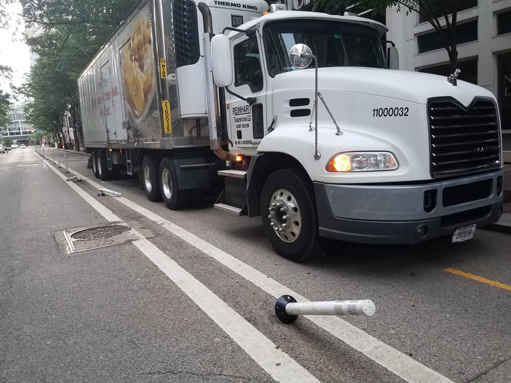
In October, you may have participated in or read about the Data Protected Bike Lanes Project that we hosted in collaboration with the How’s My Driving app. Volunteers recorded over 120 vehicles blocking bike lanes during morning, lunch and afternoon rush hours in a single day. Over 40 volunteers helped make the event a huge success and captured the imagination of advocates, as well as a lot of media attention. Due to the positive feedback and general excitement about the potential of the app’s utility, we decided to formally partner with the developers to help further our advocacy efforts to curb poor driving.
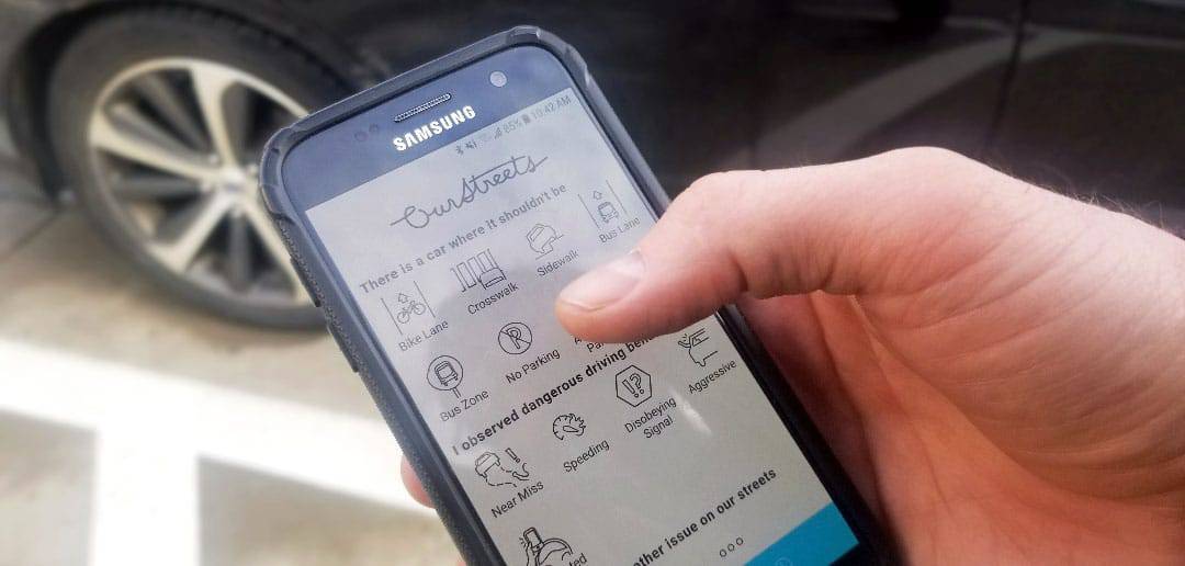
The app, now called OurStreets, is a one-stop shop to crowdsource dangerous driving behavior and “near misses,” or other dangerous situations such as cars parked on a sidewalk or in bike or bus lanes. For example, if you are riding in a bike lane, and you approach a vehicle blocking it, you can simply stop, snap a picture, and upload the information to the app.
All OurStreets reports in the greater Pittsburgh area will feed into a dashboard that will allow BikePGH staff to easily gather insights overlaid with crash data, citation data and other relevant data sources to tell a fuller picture of what’s happening on our streets. We will then be able to use these insights to drive our advocacy for street safety initiatives throughout the region.
While OurStreets is indeed similar to the City’s 311 reporting system, we found that 311 is great for issues such as potholes and faded street markings, but it is not so effective when it comes to reporting dangerous driving and behavioral issues. We encourage everyone to continue to use 311 for infrastructure-related issues within the City of Pittsburgh.
OurStreets is now available for download on both Android and iOS. The OurStreets team goals is to work directly with key stakeholders in the Pittsburgh area and beyond to drive advocacy and infrastructure projects, and identify hotspots in order to make our streets safer for all users.
Spread the word!
We encourage you to download and use OurStreets anytime you experience dangerous driving. OurStreets is available for use anywhere in the US. Additionally, the OurStreets team recently agreed to a partnership with the League of American Bicyclists, so submissions both in and out of the Pittsburgh area will be going toward their advocacy efforts as well.
Tips on using the app
OurStreets launched about two weeks ago for Android and iOS, so it’s still early days for the app. Even still, there are some great features the app provides that make it flexible, safe, and fast.
For instance, we understand that, due to circumstances, you may not always be able to snap a photo, which is why everything in the OurStreets app is adjustable and/or optional. The app can also use a photo’s timestamp and location, this way users can snap a photo and submit when it’s safe and convenient.
The app also uses automatic license plate recognition software to read state and plate number instantly without user input. It’s not always perfect, so OurStreets zooms in on the photo, so you can easily determine if any edits are required.
What’s Next?
Be on the lookout for more announcements about this exciting partnership including the second Data Protected Bike Lanes Project to be held this Spring. If you want more frequent updates from the OurStreets team, follow them on Social Media (Twitter, Facebook, LinkedIn) and sign up for their newsletter on their website.