Traffic calmed streets to feature prominently in bike network expansion
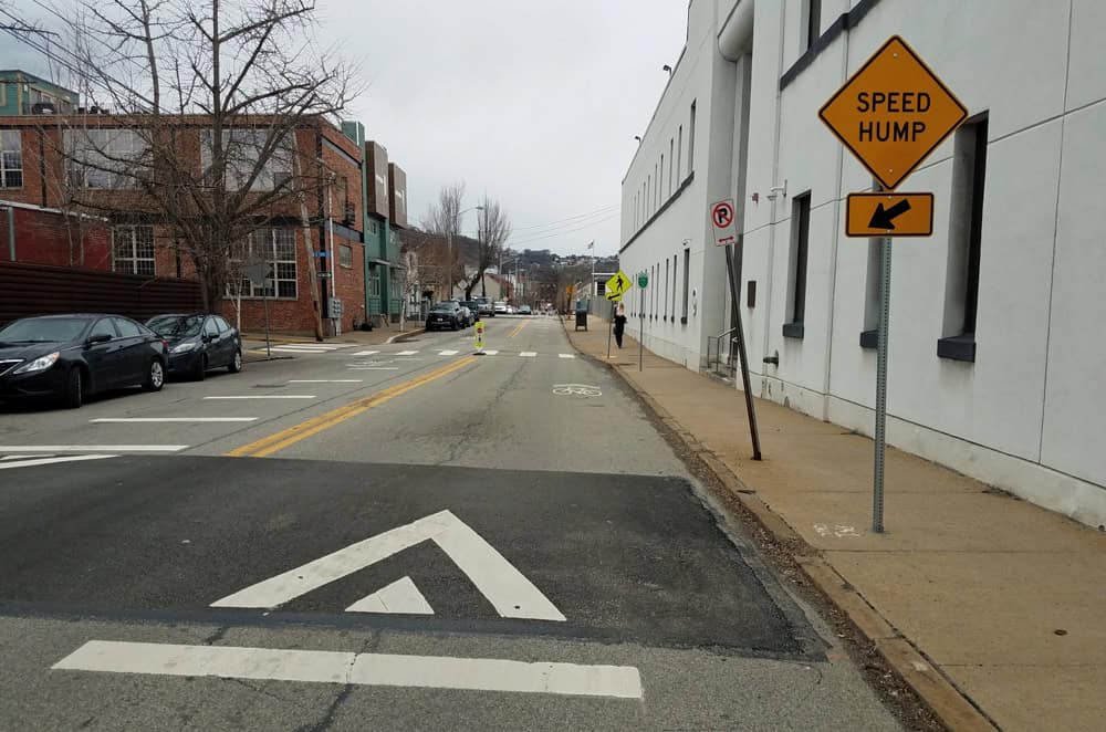
You may have noticed some new signs and speed humps in the South Side. This is the City’s first “Neighborway,” a new street type in the City of Pittsburgh. Neighborways are a new tool that the City is using in order to build out a connected citywide bike network, something that is getting increasingly more difficult as the wider streets got outfitted with bike lanes, leaving the narrower residential streets to fill the gaps.
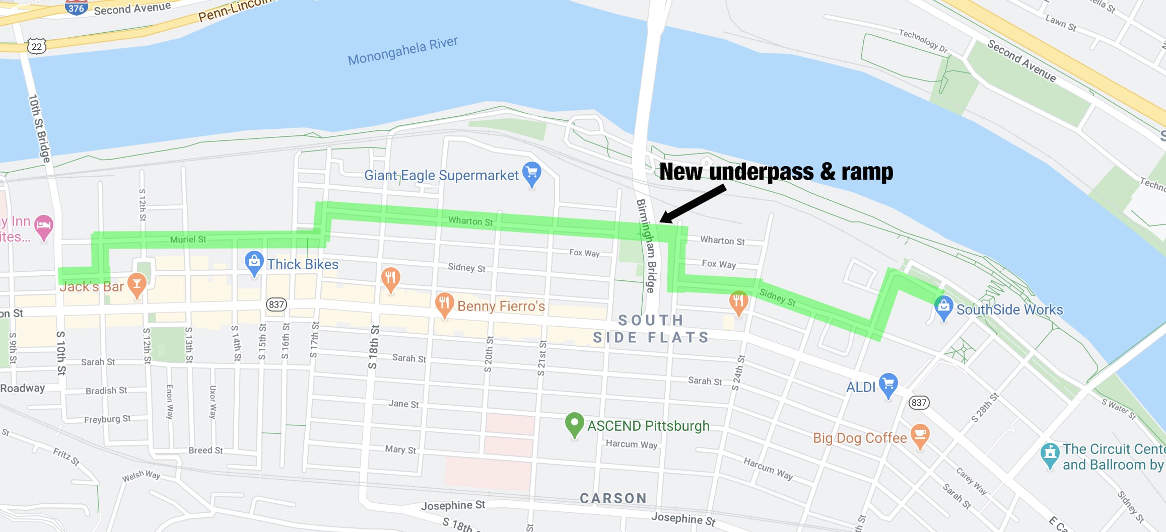
Extending from the 10th St Bridge to the SouthSide Works, the Neighborway has been outfitted with signs, speed humps, sharrows, and other features to help brand it as a bikeway.
Additionally, they are about to open a brand new underpass and ramp below the Birmingham Bridge, to provide a direct connection for bicyclists and pedestrians. The overall intention is to provide a low-stress alternative route to the busy E. Carson St.
What is a Neighborway?
A Neighborway is the newest street type in the City of Pittsburgh. It’s a street, or series of connected streets, where motor vehicle speeds and volumes are kept low to make it more comfortable for existing residents, while also making it safer to walk, ride a bike, and for kids to play.
Neighborways are located on low-volume residential streets and provide a low-stress alternate route to a major arterial, while discouraging drivers from using the street as a cut-through. As the streets are traffic calmed, and do not include dedicated space (like bike lanes) for bicyclists, the impact on parking or the existing street layout is minimal.
Whether you drive, walk, roll, or play, your street will be safer, and your transportation options will improve. Neighborways are identified in the City’s Bike(+) Master Plan as a tool to help create the connections toward a low-stress, all ages and abilities bike network.
How does the City create a Neighborway?
The City’s Department of Mobility and Infrastructure has a toolkit for creating Neighborways, including:
- Pavement markings: You may see new markings such as sharrows, to alert drivers to expect people riding bicycles and to help guide people riding bicycles along the route.
- Intersection Improvements: A majority of crashes occur at intersections. Improvements such as bump outs, Neighborhood Traffic Circles, and high-vis crosswalks make crossings safer.
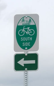
- Signs: You’ll see the standard Neighborway sign for branding, as well as regulatory (Bikes May Use Full Lane) and/or wayfinding signs.
- Managing vehicle speeds and volumes: Speeding is dangerous and commonplace. Speed management tools may include speed humps, bump outs, trees, Neighborhood Traffic Circles, etc. in order to physically slow down drivers, or discourage them from using the street as a cut-through in the first place.

Where are there Neighborways?
Currently, there is one Neighborway that is nearly complete in the South Side. The City has labeled a series of streets including Sidney St, Wharton St and Muriel St, between the SouthSide Works and the 10th St bridge as a Neighborway alternative to E. Carson St.
Other Neighborways that are currently in the planning phase include:
- Central Lawrenceville – Hatfield St and Willow St between 39th St and 50th St, including a bike/ped underpass below the 40th St Bridge
- East Liberty/Highland Park – Euclid St
- Point Breeze – Reynolds St, between Beechwood Blvd and the Hawthorne Trail
- Bloomfield/Friendship – Coral St and Comrie Way
- Manchester – A cluster of streets within the neighborhood
- North Oakland/Polish Hill – Upgrades to Gold Way and Melwood Ave
Project Fact Sheets are available at: pittsburghpa.gov/domi/current-projects
More on Neighborways: pittsburghpa.gov/domi/neighborways