Unfortunately, I am hearing it won't be finished this year.Hopefully it will be finished in 2013,but even that is no guarantee.Can't wait till it's completed
2012-08-30 22:08:34
when will the last section of the GAP be finished? i heard november. is this true?
Unfortunately, I am hearing it won't be finished this year.Hopefully it will be finished in 2013,but even that is no guarantee.Can't wait till it's completed
What's the hold-up? Seems like Pgh would want to capitalize on that trail and showcase the Southside & downtown. What a bummer!
Eta 13/13/13
Ha!
In the year 2525...
this thread: http://bike-pgh.org/bbpress/topic/steel-valley-trail-1/page/2#post-113865
6 or 7 messages up from the bottom, has a link to this newsletter: http://www.steelvalleytrail.org/eNewsletters/eNewsletter120827.pdf
which gives some info...
Take Away: Not this year. Likely not next year. "They" really are working on it, there's just not a large number of "them".
"There is a lot happening along our trail and adjacent segments. We hope to make the longawaited, official connection of the Great Allegheny Passage with the Three Rivers Heritage Trail this spring in time for the 2013 biking season."
That kind of sounds like next year to me. No guarantees, obviously, but I don't see anything in that newsletter that says "Likely not next year."
I've been driving by Keystone Metals all summer long and there was a lot of earth movment until about a month ago. It stopped for most of August. Monday it seems to have picked up. I'm not sure if that activity is trail related, but I think it is. If you Google Keystone Metals and GAP, you'll find some pdf's with PA DOT related work. It looks like spring 2013 is a bit optomistic, we can only hope. I'm about ready to take a few bags of concrete to the make shift trail along the tracks to fill in the areas where the rain cuases huge puddles!
Alan, you're hopefully right. My assumption was based on the advertised completion dates for 2009, 2010, and 2011. I suffer at times from "the only good date is in the past"-itis, something that makes my attempted eternal optimism difficult at times.
I guess glass-half-full analysis should dictate: if they've been close enough to advertise a completion date for so long, they can't help but complete it very soon (next year is soon!).
Those interested in keeping up-to-date on the status of this section of trail can also follow the Steel Valley Trail Council on facebook (http://www.facebook.com/SteelValleyTrail). I think we should be linking to all newsletters on there, which will include any trail construction updates as we get them.
@sarapgh2 great idea. and, thanks everyone for the information and discussion. if they'd let me dig and pour concrete, i'd be happy to help get this thing FINISHED!
we should make one of these threads a sticky ")
there is going to be one hellava ribbon cutting party when it does get finished....if they can stop people from riding through that section long enough to put one up.
Someone told me that the major detour on the C&O canal will even be finished next weekend (the 7 mile detour south of Williamsport around the washed out section of trail).
Now, people run their mouth all the time and have no idea what they are talking about, but is that true? That was the first I had heard anything other than "They are never going to fix that mess."
Would be pretty sad if they can fix THAT section before they can finish a 1/4 mile path to the sandcastle parking lot.
The "trail" through McKeesport is pretty crappy too but it all seems to be gettting nicer as the years go by!
I'd love to see the day when you can actually go from point park to the end without being on a road (much). I doubt it will ever be 100% road free.
It was nice last weekend to go on a long ride without getting honked at for once! I did get some a-hole jogger just outside of D.C. screaming at me calling me a "MF" and all that, but I expect that from the assholes who live down there. D.C. is my least favorite place on the entire earth.
@adam where did you get the info. about the big slackwater detour being finished soon? we're riding from hancock into DC at the end of september. having pedaled the whole thing, from pitt to DC back in june, and enduring the 6 mile detour in the heat of a very hot day...MAN, would it be awesome to NOT have to endure that again.
This NPS page (dated July 2012) says "Work on the elevated walkways and the towpath is expected to continue in the next several weeks as the contractor moves toward substantial completion of the project." There's no more definite completion date on that page (but there is an NPS phone number there for more info).
There's been continual low-level chatter about this on the C&O Canal Yahoo Group, it was originally scheduled to be done in May and it's been slid twice. Things we're sure of: there's definitely a lot of work being done and money being spent. Rumor: going to be open soon. It might be worth posting your question on the C&O Yahoo Group.
Thanks Steven & Vannevar!
@julieb — it was some random dude I met on the trail. I don't mind the detour myself other than the steep climb up past the barns (going south). I had to walk that one since my loaded bike felt like it was about 60lbs and by that point my knees were a bit pained... However the ride on pavement for the 6 miles or so was a nice break on the ole' taint!
It is amazing how slow you feel once you get onto roads with rolling hills etc. after you have been on a flat rail trail for over 200 miles though! I was REALLY concentrating on carrying enough momentum on every downhill stretch to carry me back up the next hill.
I have yet to ride my bike since I got home the other day and I can't wait to see what it feels like after getting all that weight off the back!
I just rode from pitt to dc about 3 weeks ago and we talked to two old gentlemen that ride that section almost daily. They both said, when there is no construction workers there they ride through that section. But the day we talked to them they didn't make it through because they had a crane in the middle of the trail.
putting what they said together with what Adam discovered, I wouldn't be surprised if it's ready by the end of September.
@adam, you're right. there were stretches on that detour that weren't bad, and a nice reprieve from the trail. still, i too had a heavily loaded bike (my first "tour" and i was carrying way more than i needed), and with the heat the day we were riding, it was just plain hard.
@rambo, i hope you're right. we'll be on that stretch on friday, sept. 28, so i would most likely not stay on the trail in the event that we might end up having to turn around and backtrack.
I wish you luck! We were hoping it would be ready for our ride and were very disappointed when it wasn't. I wouldn't suggest riding through unless it's official open for the reason you posted, it's hard to back track when you're through riding.
FWIW I came across a semi-recent news story discussing this.
Big Slackwater section of C&O Canal to reopen soon
Dated 8/19, the article says
Copenhaver said the park service hopes to reopen the area around mid-September.
SOOOOOO awesome!! can't wait till my next pitt to DC ride...
I have to agree about back-tracking! I was willing to play chicken with a 1200lb bull because I didn't want to have to turn around and take a detour around that section of trail so badly. I'm glad I had the sense to run away and wait until other bikers joined my "posse" to convince it to get off the trail first though!
I also had way too much crap with me, most of which got used, or are things you need to bring but hope you never use. I just got these VERY BIG Axiom Dutch Shopper panniers and other than some rigging with paracord to keep them from flopping into my spokes those suckers hold a TON OF GEAR compared to most other panniers I see. They are not the best quality in terms of waterproofness etc but they are so large I carried way more than necessary to do the trip and didn't have any other "baggage" whatsoever on the bike or back.
I still haven't had a chance to go riding since I got back but am greatly looking forward to feeling a normal weight bike under my legs when I can this week!
Man — only Sandcastle remains in the way of having a completed trail! It would be SWEET to be able to do that ride next year if it is 100% finished! All the new sections are pretty nice riding — albeit McKeesport is a bit of a mess, but it keeps getting better. I really like the solitude and peacefulness of this ride and it allowed me to hammer out so many miles my metabolism has been on fire since I got back. I've dropped 10lbs in the week or so since I got back with no effort.
the sandcastle gap doesn't bother me. it's so easy to get around.
@Vannevar That is good new! Particularly the pic.
I was told when I went through there three years ago, taht even if they fixed it, it would just wash out with any kind of spring high water, but the pic shows concrete - which will be a mess during aflood, but quick enough to clean up.
I agree that the Sandcastle section is easy enough. The railroad gravel has been ridden on so many times only a small stretch of THAT is even "lumpy" anymore — but it still would be nice when it is "officially" done.
That concrete stretch on the C&O will be just as nice of a crotch break as the paved road detour it seems with the added bonus of not going on a 7 mile ride just to be one mile closer to the end.
speaking of the "crappy" surface on the C&O. I talked to an old guy in OLDTOWN, MD just before the paw paw tunnel, he said they are stocking up on crushed limestone just down the road and are planning a huge resurfacing of the towpath in that section. I've also seen where they started upgrading the path in other section too. Maybe after the big slackwater detour is finished the money will start going to making the towpath surface better.
When the twopath was made into a park, it was intended primarily as a hiking path.
There is a constituancy which would like to see the trail remain as close to it's original state as a mule path. Those folks aren't jerks or anti-bike or anything, they just want a little historic preservation.
The only reason we have the C&O is the historic preservation perspective - and for years before we had the GAP, the C&O was just outstanding. I rode the C&O in 1994 and I thought it rocked. Now that I'm spoiled by the GAP, the C&O could suffer in contrast.
They're different things; steak and ice cream, and if I may you've got to enjoy each one on it's own merits.
The GAP is a relatively new trail built with modern techniques, materials, engineering techniques and contemporary safety standards.
The C&O Canal trail is a Civil War donkey path. I really really enjoyed parvipica's comment, "When people say the C&O towpath is rustic and primitive, what they mean to say is that it is a shitshow squirrel path tour of hell."
There's a lot of history along the C&O and for a lot of people, paving or changing it is anethema and I get that. It's all good.
I think a reasonable compromise can be made using crushed limestone to produce a trail with a reasonably smooth surface that still retains the link with the trail's history. The way it is now, the trail is not really being maintained for any use, so it ends up being a walking trail since that's the least demanding use. And it's not really usable as an extension of the GAP since that accommodates all types of riders and the C&O trail is really only good for mountain bikers with suspension.
I am not opposed either way. I don't think the C&O trail is so bad that you can't ride it with a road bike. I won't really ever ride a mountain bike on it again. My only "problem" was that my shimano racing wheel got a little out of true getting "beat on" by some rougher trail coupled with my overweight ass and heavily laden panniers putting un-necessary forces on the wheel.
I never thought the surface was too rough to ride though. It does suck when it rains and those tire ruts fill with water, but even the GAP trail surface turns very slow when it rains and it goes from feeling like pavement to your wheels being sucked down into the surface.
Just ride the widest road tires you can use on your rims (700x28s or wider) and have some sort of tread.
You do need to pay more attention on the C&O in my opinion. I literally fell asleep (like a car drifting into the rumble strips) once on part of the GAP near Cumberland while riding 160 miles in a day — but I don't think there is a stretch on the C&O which would be forgiving in that respect LOL.
There are certainly more spoke busters — sticks and branches that like to reach out and wedge themselves into your wheels on the C&O.
I was actually remembering the C&O to be much worse than it was last week when I rode. I hadn't ever ridden that on a road bike before and was expecting to get much more beat up than I did over it. Although I was fine riding the C&O into the late hours of the night on my mountain bike where I never felt safe riding after dark on the road bike since a MTB is more forgiving if you run over anything harmful to the wheels.
Historically speaking — was the C&O towpath ALWAYS a set of 2 ruts running in parallel? I think bike traffic has already made the trail historically inaccurate!
Reminds me of the south side historical Nazis running around suing people for using the wrong kind of paint on signs, yet letting corporate monstrosities like the "KenTacoHut" to open up and do what they want.
I'm sure the "original" C&O path in Cumberland wasn't laid out in nice red brick as a path through town surrounded by nice bars and restaurants.
You might think crushed limestone is a reasonable compromise, but there are historic presevationists that do not agree.
They really want two tracks with mud. That is what the trail was when there were canal boats and that is what they want it to be now.
I hiked along with one as a break from riding when I did one of my trips.
I do believe the trail was initially made by teamd of mules walking two parallel. I could be wrong about that.
@Vannevar thanks for the info. a few days ago. Awesome! Hope it is reopened for our ride at the end of the month.
didn't mean to spark a debate with my comment...for the record, I love the C&O just the way it is. I'm a "mountain" bike tour'er so I don't mind the surface at all. It's what makes the C&O the C&O in my opinion.
@Mick..yup. teams of mules (NOT donkeys) walking side by side in groups of 4 or 6 (mostly). For longer trips a spare team was stabled in the front, lower section of the canal boat.
there's something to be said for preservation, but even if there were mules hauling barges still, I'm sure the mule drivers wouldn't scoff at a less muddy surface for their mules to traverse. We've still got the canal, we've still got a path, it's still motor vehicle-free. Resisting all improvements makes as much sense as causing a huge stink when someone brings up the idea of moving ARB's granite curbs a few feet to accommodate a bike/ped lane.
It's a balance between remembering the past and the needs of current inhabitants. It always surprises me when people assume we can't do both.
i'm riding pgh to DC in a 24 hour relay tomorrow, hopefully that detour will be passable. anyone have any recent info on the C&O construction?
@ejwme It's a balance between remembering the past and the needs of current inhabitants.
My impression is that the hikers -understandably - would rather not have the path totally overrun by bicyclists. Hence the resistence.
Now there is a paved path, Western Maryland Rail Trail, parallel to the C&O. It's currently for short distance (~20 miles) around Hancock.
Bikers find a it a respite from the muck when there is rain. There is a movement to complete that trail. Complete from where to where I don't know.
From the WMRT site
IMPORTANT NEWS: Gov Robert Ehrlich anounced recently that the State Department of Transportation and the Department of Natural Resources will spend $5 million for 4.5 mile extension of the WMRT. The new section will run between Pearre Station and Little Orleans, Md, with access through the 4,400 foot Indigo Tunnel. The trail extension will be in conjunction with the National Park Service.
That is one hefty tunnel. The Big Savage Tunnel is 3300 ft.
When the WMRT is done, I doubt many bikers would go for long on the C&O in the areas the WMRT covers.
Here's a National Park Service page with their recent Environmental Assessment for extending the WMRT (currently 22.5 miles) another 15 miles, from its current western end past Little Orleans and all the way to Paw Paw.
I wonder what percentage of cyclists, if any, intentionally take the C&O for the portion paralleled by the WMRT today.
If you ride that way you'll find the trail is far more overgrown in the section the WMRT covers. So I would say, complete the WMRT and leave the C&O to the people who like walking on an old mule track.
Oh, and the WMRT "news" is from 2006. Gov. Erlich left office in 2007. Since then, it looks like they've decided to keep the Indigo Tunnel closed to protect the bats that live there.
They may start construction on the extension, funded in 2006, later this year. Hmm, I don't think Sandcastle was involved with that one.
Here is some good news on this issue.
WORK HAS STARTED! We rode by today and saw tree removal in progress in the Sandcastle parking lot. Stopped to ask and YES - they're working on the trail! Caruso has the contract for the work and there was also some guys from a tree removal service assisting. They said some trees had already been removed over at Keystone Metals, but we couldn't see that work area.


Woo Hoo!!!
OT, but I bet somebody here knows. While riding between Harper's Ferry and DC in August, my friend and I had a disagreement. I thought that the mules towed the canal boats both ways but my friend thought they towed them only upsteam and the boats just floated downstream with the current. Can anybody definitively settle this?
Yes! That's so exciting to see some actual work being done
"expected to be finished by next spring."
Nice!
Great news! I like how the article says work will start in October, but it's actually already started. Hoping the completion date slips backward in the same fashion!
Regarding canals, I think the locks prevented significant current flow. The water between one lock and the next (the canal pound) is at the same level throughout, so it doesn't flow anywhere (apart from the bit of water that gets through during the actual use of the lock).
Here's a page with old photos of canal boats on the Erie canal. One's headed eastbound, one west, and the captions imply that both will be towed by mules.
I studied canals a bit in college, focusing on the Genesee Valley Canal (1840-1878), which connected the Erie Canal at Rochester NY with the Allegheny River at Olean NY. It had a series of 24 back-to-back locks between Nunda and Portageville, and while a current was said to exist in this segment, it was more an annoyance than a help. Two-way traffic, one towpath, and ropes connecting barges with mules for both, was a much larger factor in how and when anything moved.
Nice to hear that they will start working on the Sandcastle part of the trail,but does anyone have info on when the other 2 parts,( Homestead and wharf to the point), will be finished?? Sandcastle is just 1 of 3 parts of the gap
Man, this is really turning into like the intercontinental railroad, trying to get this thing connected
We need a section of golden asphalt or something when this is finished
@bhattenb -- That was a great question! I tried to find a photo but couldn't. Meanwhile I think Steven has posted the correct answer above. The elevation changes required were made with the locks. The stretches between the locks were level. Think about how the towpath drops only at the locks.
I am guessing the engineering reason for this that if you had sufficient drop to generate a current you always would be losing water by it flowing out of the canal and that would have to be replaced.
Even with loss of water minimized this way, there would still be water loss at the locks as you raised and lowered the water levels in them. IIRC to compensate for this, the canal had intakes from the various streams it crossed where it could draw water out of them to replace what was lost.
And now for an encore -- just point me to this if you know. If they had mules pulling boats both ways, how did they get the harness lines from boats on the east side of the canal past the harness lines of boats on the west side of it without them getting tangled?? Hand them to the boat on the west side to give to whomever was walking on the towpath with the mules? (I can just feel the brickbats coming at me already.)
Thanks for the lesson, guys. I also wondered how they kept the lines from getting tangled when two canal boats passed.
Totally guessing here, but say one canal boat is hugging the shore next to the tow path, and its mules are also hugging the shore. A canal boat trying to pass it (going in either direction) would then take the bank farthest from the tow path, and its mules would pass on the outside of the other mules. The only problem then is the second boat's rope, but if they could just lift that up above the inner boats and mules they'd be all set topologically. Maybe the inner boat and mule guys used long poles for this.
Also, here's an updated PG article with more details. (I'm assuming "This portion is not expected to be completed by spring of 2013" is supposed to read "This portion is not expected to be completed until spring of 2013" or maybe "This portion is now expected to be completed by spring of 2013".) It doesn't address the two downtown links though.
If I had to guess, I would say they would just unhitch one team when passing, it wouldn't be that big of a deal.
Also, is there still a plan for a "Mon wharf connector" to the point? If there is, I vote for it to be killed. The solution to that stretch should be a separated bike lane on First ave from Pnc to Point Park. It's a heckuva lot more do-able and cost effective. It would be usable by commuters to the Smithfield bridge. Three car lanes on First avenue is foolish. I think all energy should go toward that.
we're quite confident that there weren't paths along either side during the glory days? I've never been along this canal, but most other canals I've been along have had paths on either side, even if they're precarious and barely wide enough for a mule (those creatures can be quite nimble). If only one side was preserved, the other side could just as easily fall in or grow over or otherwise disappear, leaving us with half the story.
As far as I know, they're still planning to build both the switchback ramp (wharf to Smithfield Street bridge) and connector (wharf to Point State Park).
One problem with converting First Avenue is it would require cyclists to cross a bunch of streets, which the trail is trying to minimize as much as possible. There aren't even traffic lights on those intersections now. And First Avenue doesn't seem to cleanly connect at either end: at the west there's a staircase, and at the end a parkway ramp is blocking the way. By the time you address those problems with new ramps and traffic lights (assuming the city was OK with that), the cost might be comparable to their current plans.
Re: canals, I believe there's a tunnel on the C&O with a ledge along just one side of the canal, for what that's worth. From the photos it didn't look like there was ever a ledge on the other side. Also, the historical Erie Canal photos I linked above show boats heading in both directions, but the mules always on the same side. But that's not definitive. Good question!
I agree that the Jail-Trail?Point-State-Park connection is an annoyance, but it's not all that bad at this time (assuming you're coming from the east).
1) Take the walkway to Smithfield; wait for the light. Go to 1st.
2) Left on 1st to the end onto Stanwix, cross the lanes to the left turn lane, turn onto the Boulevard.
3) right on Commonwealth Place then left into the park.
On the way back just go back up the Boulevard to Grant, left on 1st and on to the trail.
No, you can't just sail through.
But it's a city. You're not the only thing on the road. Deal with it.
@Steven http://www.morriscanal.org/kids.htm -- qustion #7.
@Mikhail: Thanks! So instead of lifting the outer rope over the inner boat and mules, they drop it beneath them. Makes sense.
@Ahlir: Thanks for the route. Still, if we can "deal with it" by building a new route that bypasses all the intersections and cars, I think it'll be a lot better.
@mikhail -- Thank you! Makes perfect, practical sense. Steven almost got it right. I wouldn't have thought of it.
One of the things I find most interesting and enjoyable about this board is the number of bright people who think of questions like this and then go hunt for anwers to share with the rest of us. I keep learning fascinating off-the-wall stuff from the rest of you that I wouldn't have ever thought of myself. Dudes, cool. Really cool. Thanks so much for it.
@edmonds: why not both? absolutely, 1st ave is overused (or underused, depending), but once the connection through the mon wharf is done, you could possibly have a 100% car-free route from point state park to the east end. that is, in my mind anyway, a spectacular encouragement to anyone who might think "it's too hard" to hop on a bike and take a look at our beautiful city. travel across a city without every having to deal with automobile traffic? get out of town! or don't, because you don't have to! love it.
+1 HV. Also think about all the non-bike users of the Jail Trail who might want to continue to Point State Park, but not if it means rollerblading while pushing a baby carriage down a First Avenue sidewalk and braking for buses.
On the other hand, we'll still need a route for when the wharf's under water or covered in river gunk. So any improvements to the First Avenue/Blvd of the Allies bike route would still be worthwhile even after they build the switchback ramp and connector.
The real drawback to the Mon wharf connector is that it does nothing to tie all the cross streets, Smithfield, Wood, Market, Stanwix, into the EFT as a commuter route. Those streets are all much easier to negotiate than the "spines" of First, or the Boulevard. Getting to or starting from the Point is great for tourists who want to say they went from DC to the point. I'm thinking of getting more bike facilities on the streets for everyday. And I'm talking about a separated bike lane, take away a car lane at First, add a curb, so the moms with the strollers are comfortable. I don't think it's nearly as difficult as you make it sound Steven. There are lights at those intersections, I stop at them. There's already a ped crossing at the Grant St ramp, just extend it to First. I'm not sure what steps you're talking about at the other end but it's got to be technically easier than this Smithfield ramp. With downtown trending to more residential, I bet all the new residents along First would be big supporters as well.
You could eliminate the parking lane on Ft Pitt blvd and put in a protected bike lane without much work. It would just require a change to the traffic light at the end of the trail - where you cross to the mix use sidwalk to the smithfield bridge. It could be an on-demand push button only cycle so it wouldnt slow up the intersection when no one needed to cross.
Or just eliminate all car traffic downtown like during the G20. That was fantastic!
I wonder if there's a small name mix-up here: First Ave is one lane plus parking and has almost no traffic lights. Fort Pitt Blvd has two lanes plus parking and a light at every intersection. The Furnace Trail ends at Grant and Fort Pitt--to get to First towards the Point from there, you have to go up to Allies and around the Parkway ramps.
+1 Endmonds59. It certainly would signal downtown as a "place to live" rather than a place to leave at 5pm.
Holy crap yes, I've been talking about Fort Pitt. Apologies. Good spot BB.
The best way to get to 1st (or Ft.Pitt) is to cross the street at the end of the trail and go along the walkway to the Smithfield Bridge. Wait for the pedestrian light. Then go to the Ft. Pitt intersection. You now have a choice between turning left right away or proceeding one block and turning left. I personally prefer Ft. Pitt since you end up stopping fewer times and the Commonwealth bit is simpler. You don't want to get onto Ft.Pitt right at the trail: some lane of cars always has precedence.
Yes, Ft. Pitt should get a dedicated bike lane (starting at Smithfield) and Commonwealth should be sharrowed.
While we're at it: Once you cross the bridge to the north "shore" it's hard to cross the street (coincidentally, North Shore Dr). There should be a light activatable by bikers and pedestrians.
> While we're at it: Once you cross the bridge to the north "shore" it's hard to cross the street (coincidentally, North Shore Dr). There should be a light activatable by bikers and pedestrians.
Oh my yes. I'd almost always rather take one of the three-sisters bridges when practical for just this reason.
(ETA: 311'ed.)
You could eliminate the parking lane on Ft Pitt blvd and put in a protected bike lane without much work.
There's not a lot of parking to remove on Fort Pitt Blvd. From Smithfield to Wood, parking is prohibited. From Wood to Market, parking is prohibited between 4 PM and 6 PM. From Market to Stanwix there are about 5 unrestricted parking spots, and from Stanwix to Commonwealth it's two lanes with no parking.
The bigger problem is turn lanes, not parking. Westbound, it's got three turn lanes at most intersections. Does it need all three during rush hour? Assuming it doesn't, a bike lane there would need to be carefully designed because of all the car traffic turning on and off it. Bike boxes maybe.
Are the folks proposing a bike lane for Fort Pitt Blvd talking strictly about westbound bike traffic? If there's to be an eastbound bike lane there too, there are more issues (like just where you'd put it).
I have in mind one 2-way separated lane on the inland side of Fort Pitt.
The other thing I think I was sub-consciously sensing is that almost no cars make right turns from Ft Pitt, they are all trying to go left to Parkway ramps, at least until all the way until Stanwix and Commonwealth, and by then car traffic is quite thin.
I suppose what I'm thinking is that, there seems to be an enormous amount of technical and financial gymnastics being expended toward construction a trail-type connection at this location to the Point, when I am having the feeling that the city has progressed enough that we should start proposing "easier" on-road solutions that are more integrated into the overall transportation fabric, as other cities have done/are doing.
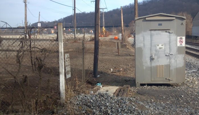
Just a picture from Keystone side. Took it today at lunch time. I did not see any activity.

Hello Mikhail, I wouldn't be surprised if the final trail path through/along Keystone Metals does not follow the tantalizing bit of pseudo-trail that we've been staring at longingly through the fence.
It would be great to see a map of what they're actually building, it's been changed a few times.
Well, I think the way of separation of bicyclists and trucks how it's supposedly done today is one of the best. Trucks cannot hurt bicyclists if last ones are 10-12 feet above in a fenced zone (so bicyclists would not send themselves down to trucks).
The Post-Gazette story http://www.post-gazette.com/stories/local/region/bike-path-slated-for-spring-2013-653427/ was accurate with its broad message, that the GAP trail construction near Sandcastle will be complete in Spring 2013. It was inaccurate, however, when it said that "of the four incomplete sections of the trail that remain, three will be finished by the end of October".
I heard a status update at a Steel Valley Trail Council meeting Monday evening from Jack Paulik, project manager for the SVT (trails along the Monongahela River between the Pittsburgh city line at Glenwood Bridge and Clairton). Jack is also project manager for the Regional Trail Corporation (RTC). Jack deserves a lot of the credit for pushing through the planning and design work for the GAP trail near Sandcastle.
Jack says that:
1) The trail work near Keystone Metals (just downstream of the Glenwood Bridge) will likely begin in October and finish in the Spring. In terms of engineering, this is the most difficult section, because a tall wall must be built and the trail must climb a small hill (about 8 feet high).
2) Work on the two sections of trail on Sandcastle property will take place in the Fall, Winter, and Spring. Utility poles will be moved, new asphalt put down, and fences built.
3) Sidewalk between Costco at the Waterfront and the current end of the GAP trail near Mitchell's Fish Market will be rebuilt. That work will start in October.
By the way, the Steel Valley Trail could use more volunteers. If you're interested in helping with mowing, cleanups, promotion, planning, or installation of benches and signs, contact info@steelvalleytrail.org .
Wow, great news!
thanks for the info/update!
such b/s that wall must still go up. i would have hoped county law department would have ceded to the elevated path constructed over the former rail bridge approach as sufficient.
at least we're employing local pile drivers and giving graffiti artists another few square thousand feet of canvas...
thanks Paul
Paul, many thanks. There's been a real info-vacuum about the impending SC-KM work and I really appreciate your message.
It's a trail, not a military secret.
There's been a lot of patient, long-term, great work on the GAP and I don't mean to diminish it, but there has also been a need for more communication. And when there's a vacuum, rumor and misinformation tend to fill the void.
My compliments and Thanks Paul!
There were two large connstruction vehicles at Sandcastle Friday. They cleared the brush and moved some brush. Looks like the work has started
I took a couple pictures of the section that durishange was talking about on sunday. Never tried to post a picture here before...so here goes....


Nice. I was there on Sunday too. Thanks for posting a picture.
I ride though this area a lot...will post pictures if I see any new progress!
Mules would have to tow the boats both ways. There would not be much of a current because of the locks and dams themselves backing it up, especially as you approached them.
However, I don't think they used the C&O canal for more than a couple years since it took over 100 years to build and this thing called the "railroad" came out while it was being built!
I grew up next to the Erie Canal in New York (not even 2 miles from it) and it is a much wider and STILL functional canal, and it is almost completely slackwater the entire length. Even when they are filling and draining it (every winter they drain it down to a few feet deep and then re-fill it in the spring, it is still slackwater and takes a few weeks for the water level to completely drop / raise.
haven't been up that way in over a week now. anyone been by to see what's going on? Post some pics!
Rode by today. No change. Nothing happening. Sorry, Rambo.
Just rode by there 45 minutes ago.No change from when I rode there almost 3 weeks ago.I doubt if it will be finished this year.
oh well..too bad! Thanks for the update!
Rode through Sandcaste today and ran into the gentleman just about to lock the gate for the day. Very nice guy. We thanked him for allowing us to use their parking lot and spoke with him for a few minutes. He said they expect the trail (at least that portion - going through SC) to be completed by spring.
Hate to put a damper on what the Sandcastle gentleman stated,but what he said and reality could be totally very different.I've also spoke to Sandcastle employees years ago who told me the trail would be going thru there by as early as 2009.I would take his statement as a grain of salt. Let's hope for the best but I'm also prepared for the worst.I'm generally an optimistic person,but I've seen much too often on trail extensions their timelines are off,not by months,but by a number of years.
Reposting from the GAP email list:
Below & attached is a flyer from Linda Boxx, President, Allegheny Trail Alliance.
It's really good news!
The Final Count-Down
Join us as we begin work on
The Final Mile
of the
Great Allegheny Passage
Friday, October 12, 2012
12:00 noon
Sandcastle, near Haysglen Street
West Homestead, PA
Special Guest Speaker
County Executive Rich Fitzgerald
http://xa.yimg.com/kq/groups/12935551/1168640315/name/TheFinalCount-Flyer.pdf
Followups from the Steel Valley Trail Council:
If you plan to bike to the event, please arrive via the Sandcastle end. Please do not come from the Three Rivers Heritage Trail end in Baldwin. That route (via Keystone Metals and CSX property) is still off limits at this time.
Also, parking will be available at Sandcastle for those arriving in motorized vehicles.
To be clear, go through the Sandcastle gate on the Waterfront side and bike/drive to the other side of the park to join the celebration.
In summary, woo hoo!
Very good news!! Hopefully he/she/they/ will tell us the day it will be officially finished and be open for cycling.Thanks.
Great news! I hope they have cookies like they did two years ago when they said it would be done in one year. (/end sarcasm)
Those were some good cookies. Too bad the intervening years of inaction have left a bad taste in my mouth.
I appreciate Steven's update and look forward to this being done. I felt bad about routing the Bike Fest Neighborhood Ride along the tracks beside Keystone Metal but I wasn't comfortable leading the group on Carson Street/837. Hopefully it will be done for next year's Neighborhood Ride.
oh man, why do they always do this while I'm at work? I might have to skip out early or take the day off. I also didn't know this had been done once already...lets hope it sticks this time right?
It's kind of interesting that the completion event will still feature a part if the trail that will be "off limits".
I guess we will see how it works out.
good cookies
Yeah, but they start getting persnickety after you've eaten a couple dozen.
I went yesterday on bike ride during lunch and decided to check status of GAP.
There is no changes on scrape yard:

and SC entrance look the same:

SC Parking Lot:


While I was at SC entrance I decided to take a look at the fence end (a lot of people were asking how to get to SC when gate is closed). So if you pass entrance and continue on the street then you should see.

If you take a look from this point back:

Past end of the fence:

A little bit further past end of the fence:
G
Look from inside of SC parking lot at the same place -- no fence:


Look from the bridge:

On a way back I decided to explore some steps:
https://maps.google.com/maps?q=15219&hl=en&ll=40.393138,-79.933688&spn=0.002323,0.00324&sll=41.117935,-77.604698&sspn=6.653234,13.271484&hnear=Pittsburgh,+Pennsylvania+15219&t=h&z=19 -- just between entrance to East Carson (the first right) and the second right to Glass Run Road -- a small rectangular shape:
https://maps.google.com/maps?q=15219&hl=en&ll=40.392989,-79.933525&spn=0.000581,0.00081&sll=41.117935,-77.604698&sspn=6.653234,13.271484&hnear=Pittsburgh,+Pennsylvania+15219&t=h&z=21


So, if anyone is affraid of Glenwood bridge then follow the two stairs and sidewalk(s):

This is West Carson street from half of the first stair:

This ramp goes to Glass Run Road and mMifflin road:

Another half of the first stair:

and you got to ramp from River Front Street -- this is the second right. You can jum on street and get to entrance to Glenwood Bridge or stay on a side walk and ride to the next stairs -- one to each sidewalk of Glenwood Bridge:
https://maps.google.com/maps?q=15219&hl=en&ll=40.393045,-79.934803&spn=0.000581,0.00081&sll=41.117935,-77.604698&sspn=6.653234,13.271484&hnear=Pittsburgh,+Pennsylvania+15219&t=h&z=21


Climb on and you are on the bridge:


Before you climb the first stair you can see another stair to River Front (far away in the middle of picture):

Side walk is in decent shape. Not too wide:


You can see other sidewalk (from the 2nd ave):

It ends up just past pole -- you should be able to see rails:

It's kind of interesting that the completion event will still feature a part if the trail that will be "off limits".
It's not a completion event, it's celebrating the start of construction. As I recall, the last one was celebrating the completion of the previous section, plus the agreement-in-principle with Sandcastle to build this new section. (Or were those separate?)
Misha, thank you for sharing the contents of your SD card...
The walkways on the Glenwood are perfectly reasonable bikeways, though you do run into the occasional pedestrian (figuratively, of course). The one enduring annoyance is the weed growth on the southern end. One year I did pack some shears and tried to do something, but that's work and isn't that what our authorities are supposed to do? (Unless, of course, they're Republicans.)
Anyway, whoever drew up the directions for the event screwed up by not directing people (ie, bikers) up the (new) Hazelwood trail then across the Glenwood to SandCastle. I mean, I enjoy bombing down the Greys Bridge as much as anyone; but it might be a shorter trip (for some of us) just doing the Glenwood.
A couple of recent photos, just an update FWIW.
Standing on Haysglen Street between Sandcastle and Keystone Metals, looking toward SC-CostCo-Waterfront:
Not a lot of change, but in the last week or so the fence running along the tracks has been removed for the first 100 feet or so. It seems like the only fence remaining is to keep cars out. (Also, the mini-person-gate has been consistently closed-but-unlocked, which has been awesome)
Standing in the same spot, looking toward Hot Metal Bridge:

So there's progress.
It is very exciting to see progress.
I rode through this morning. There are a few rolls of cyclone fence in Sandcastle's parking lot. Workers are busy taking out the old fence and clearing the area near the railroad tracks. There is no change to the area near Keystone metals as is posted above. I ride through a few days a week and will keep you posted. If someone can private message me as to how to post pictures, I'll do so as I see more progress.
so this is my commute to work... i have been avoiding it and just riding the glenwood bridge for a while, do you think it's safe to say I can reasonably pass the fence area and ride through sandcastle without having to throw my bike over anything or get hassled by anyone?
Can't guarantee anything, Mark, but every time I've gone through there lately the man-gate has been unlocked. I understand that they'd like us to keep it closed, but that's a small thing to ask for the privilege of being able to cut through there. I think it's incredibly kind of them to let us do that. We ran into the guy locking the big gate a couple of months ago and he was very nice and had no problem with us being there. I think you'd be much better off/safer there than on the Glenwood bridge.
I also commute that way regularly. Outbound I take the bridge, inbound I usually take the Keystone metal part.
Been around when CSX guys were there and they didn't say anything. Been around when a train was coming and it's a little disconcerting 
There is also a nearly complete path of about six inches or so wide from the end of the SS trail to the track crossing, which is nice
Just FYI, there is now a drilling rig and crew installing what I guess is a wall right at the end of the trail, between the trail and the scrap yard's property, where the trail-to-be slopes upward.
 Further along, the fence separating the SC roadway from the parking lots has been torn out, also to make room for shifting the roadway away from the tracks and closer to the river.
Within the SC parking lot, the trail-way has been cleared out, the Giant Sinkhole has been re-fenced to stay clear of the trail, you can see where it's going to go.
Standing between SC and Keystone Metals, looking toward HMB.
Further along, the fence separating the SC roadway from the parking lots has been torn out, also to make room for shifting the roadway away from the tracks and closer to the river.
Within the SC parking lot, the trail-way has been cleared out, the Giant Sinkhole has been re-fenced to stay clear of the trail, you can see where it's going to go.
Standing between SC and Keystone Metals, looking toward HMB.
 The tall poles look to be for the wall separating the trail from the recycling yard to the right.
While the June event celebrates completion of the trail into Downtown Pittsburgh, two additions remain incomplete: connections of the Monongahela Wharf trail to the Smithfield Street Bridge and Point State Park. Riverlife spokesman Stephan Bontrager said both projects are in final design and that about $1.5 million needs to be raised to complete construction. Officials hope to break ground for both links this year, he said.